|
|
PLEASE NOTE: This data set should be acknowledged:
Panciera, R., Walker, J. P., Jackson, T. J., Gray, D., Tanase, M. A., Ryu, D., Monerris, A., Yardley, H., Rüdiger, C., Wu, X., Gao, Y., Hacker, J., 2014. The Soil Moisture Active Passive Experiments (SMAPEx): Towards Soil Moisture Retrieval from the SMAP Mission. IEEE Transaction on Geoscience and Remote Sensing, 52(1): 490-507 |
Experiment Overview
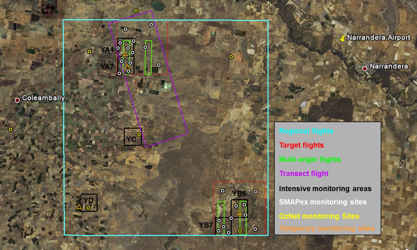
The first SMAPEx experiment was conducted between July 5-10, 2010. A total of 30 hours of flight were conducted, with airborne operations based at the Narrandera airport. Favourable weather conditions allowed observations of moderately wet winter conditions in the range 0.15-0.25v/v, with an approximate dynamic range of 0.05-0.10v/v at specific sites during the field experiment. Vegetation biomass was low, with crops (at the beginning of their growth cycle) and grass mostly below 1kg/m2.
On each flight there was airborne acquisition of Polarimetric L-band Multibeam Radiometer (PLMR) and Polarimetric L-band Imaging Scatterometer (PLIS) data as well as supporting thermal radiometers and multispectral radiometers. The only exception was the PALSAR transect flight where PLMR data were not acquired. Intensive ground sampling was undertaken concurrently with the flights and included spatial soil moisture, surface roughness, gravimetric soil sampling, vegetation LAI and reflectance measurements, destructive vegetation sampling, classification of land cover and canopy height, and crop row spacing and direction. In addition to the OzNet and SMAPEx continuous monitoring networks, 4 temporary monitoring sites recorded additional soil moisture and temperature, vegetation skin temperature, leaf wetness and rainfall data during the experiment period.
Complete details on the airborne and ground sampling activities can be found in the experiment plan and workplan addendum. The data collected can be viewed and downloaded from the menu on the sidebar. A summary of the campaign schedule is provided below.
SMAPEx-1
SMAPEx-1 Schedule
Date
Flight type
Altitude
Radiometer Spatial Resolution (m)
Radar
Spatial Resolution(m)Intensive
Ground SamplingJuly 5
PALSAR Transect
10,000ft
-
10-30m
-
July 6
Regional & Multiangle
10,000ft
1km
10-30m
YA4 & YB7
July 7
Target YB
1,000ft
100m
10-30m
YB5
July 8
Regional & Multiangle
10,000ft
1km
10-30m
YD & YC
July 9
Target YA
1,000ft
100m
10-30m
YA4
July 10
Regional & Multiangle
10,000ft
1km
10-30m
YA7 & YB5