|
PLEASE NOTE: This data set should be acknowledged:
Panciera, R., Walker, J. P., Jackson, T. J., Gray, D., Tanase, M. A., Ryu, D., Monerris, A., Yardley, H., Rüdiger, C., Wu, X., Gao, Y., Hacker, J., 2014. The Soil Moisture Active Passive Experiments (SMAPEx): Towards Soil Moisture Retrieval from the SMAP Mission. IEEE Transaction on Geoscience and Remote Sensing, 52(1): 490-507 |
Experiment Overview
The second SMAPEx experiment was conducted between December 4-8, 2010. A total of 25 hours of scientific flights were conducted between December 4 and 8, with concurrent ground sampling occurring on all days. Intense rainfall was experienced in the study area before and near the conclusion of the last day of SMAPEx-2, with 53mm of rainfall since November 1 to the beginning of sampling (December 4) and 24mm falling during the experiment, meaning that wet soil moisture conditions were experienced (0.25-0.33v/v). Due to warm moist conditions and delayed harvests, vegetation biomass was high, with crops at peak or near peak biomass (up to 4Kg/m2) and overgrown native and improved pastures (up to 1.6Kg/m2).
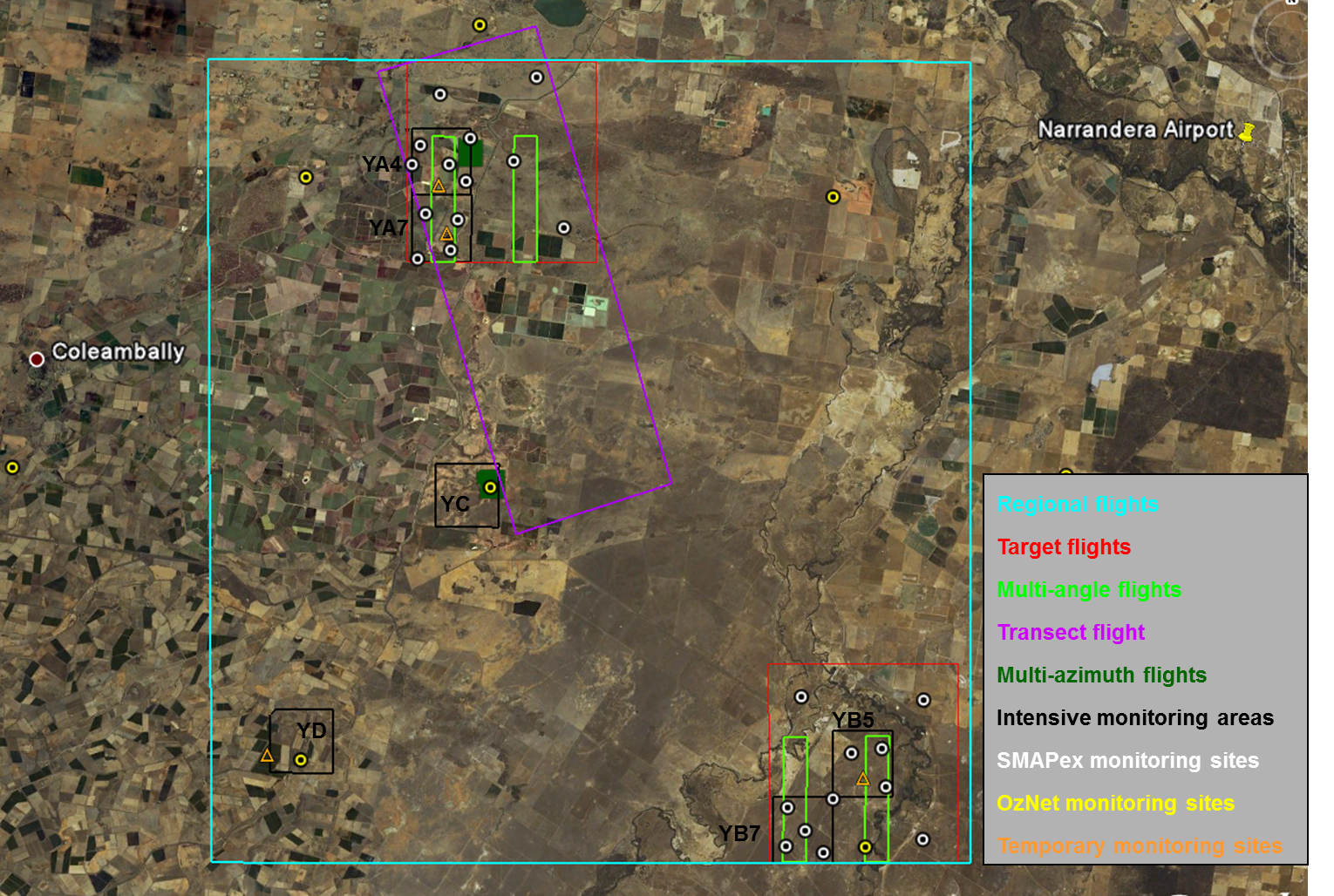
On each flight there was airborne acquisition of Polarimetric L-band Multibeam Radiometer (PLMR) and Polarimetric L-band Imaging Scatterometer (PLIS) data, as well as supporting thermal radiometers and multispectral radiometers. The exception was the PALSAR transect flight where PLMR data were not acquired. Intensive ground sampling was undertaken concurrently with the flights and included spatial soil moisture, surface roughness, gravimetric soil sampling, vegetation LAI and reflectance measurements, destructive vegetation sampling, classification of land cover and canopy height, crop row spacing and direction. In addition to the OzNet and SMAPEx continuous monitoring networks, 4 temporary monitoring sites recorded additional soil moisture and temperature, vegetation skin temperature, leaf wetness and rainfall data during the experiment period.
The intense rainfall prior to the campaign caused extensive flooding in the study area, with access to several of the SMAPEx sampling areas made difficult by standing water throughout the experiment. Mapping of flooded areas was also conducted to provide validation data for radar estimates of standing water. Complete details can be found in the experiment plan and the workplan addendum. The data collected can be viewed and downloaded from the menu on the sidebar. A summary of the campaign schedule is provided below.
SMAPEx-2
SMAPEx-2 Schedule
Date
Flight type
Altitude
Radiometer Spatial Resolution (m)
Radar
Spatial Resolution(m)Intensive
Ground
SamplingDec 4
Regional
10,000ft
1km
10-30m
YA4 & YC
Dec 5
Target YA
1,000ft
100m
10-30m
YA4
Dec 6
Regional
10,000ft
1km
10-30m
YD & YB5
Dec 7
Multi-angle
& PALSAR transect10,000ft
-
10-30m
YA4
Multi-azimuth
5,000ft
500m
10-30m
Dec 8
Regional
10,000ft
1km
10-30m
YB7