|
PLEASE NOTE: The following data sets should be acknowledged: SMAPEx-4 and SMAPEx-5: Ye, N., Walker, J. P., Wu, X., de Jeu, R., Gao, Y., Jackson, T. J., Jonard, F., Kim, E., Merlin, O., Pauwels, V., Renzullo, L. J., Rüdiger, C., Sabaghy, S., von Hebel, C., Yueh, S. H., and Zhu, L., 2021. The Soil Moisture Active Passive Experiments: Towards calibration and validation of the SMAP Mission. Remote Sensing of Environment, 59(4): doi: 10.1109/TGRS.2020.3007371. SMAPEx-1, SMAPEx-2 and SMAPEx-3: Panciera, R., Walker, J. P., Jackson, T. J., Gray, D., Tanase, M. A., Ryu, D., Monerris, A., Yardley, H., Rüdiger, C., Wu, X., Gao, Y., Hacker, J., 2014. The Soil Moisture Active Passive Experiments (SMAPEx): Towards Soil Moisture Retrieval from the SMAP Mission. IEEE Transaction on Geoscience and Remote Sensing, 52(1): 490-507 |
Project Overview
Real time information on soil moisture variability at high resolution is vital for sustainable land and water management. NASA’s next generation soil moisture dedicated mission, Soil Moisture Active Passive (SMAP), will provide this information though the synergy of L-band (1.4GHz) active (radar) land passive (radiometer) microwave observations. The Soil Moisture Active Passive Experiments (SMAPEx) consist a series of three field experiments specifically designed to contribute to the development of soil moisture retrieval algorithms from radar and radiometer for the SMAP mission. The SMAPEx experiments are currently the only pre-launch SMAP validation campaigns planned for Australia.
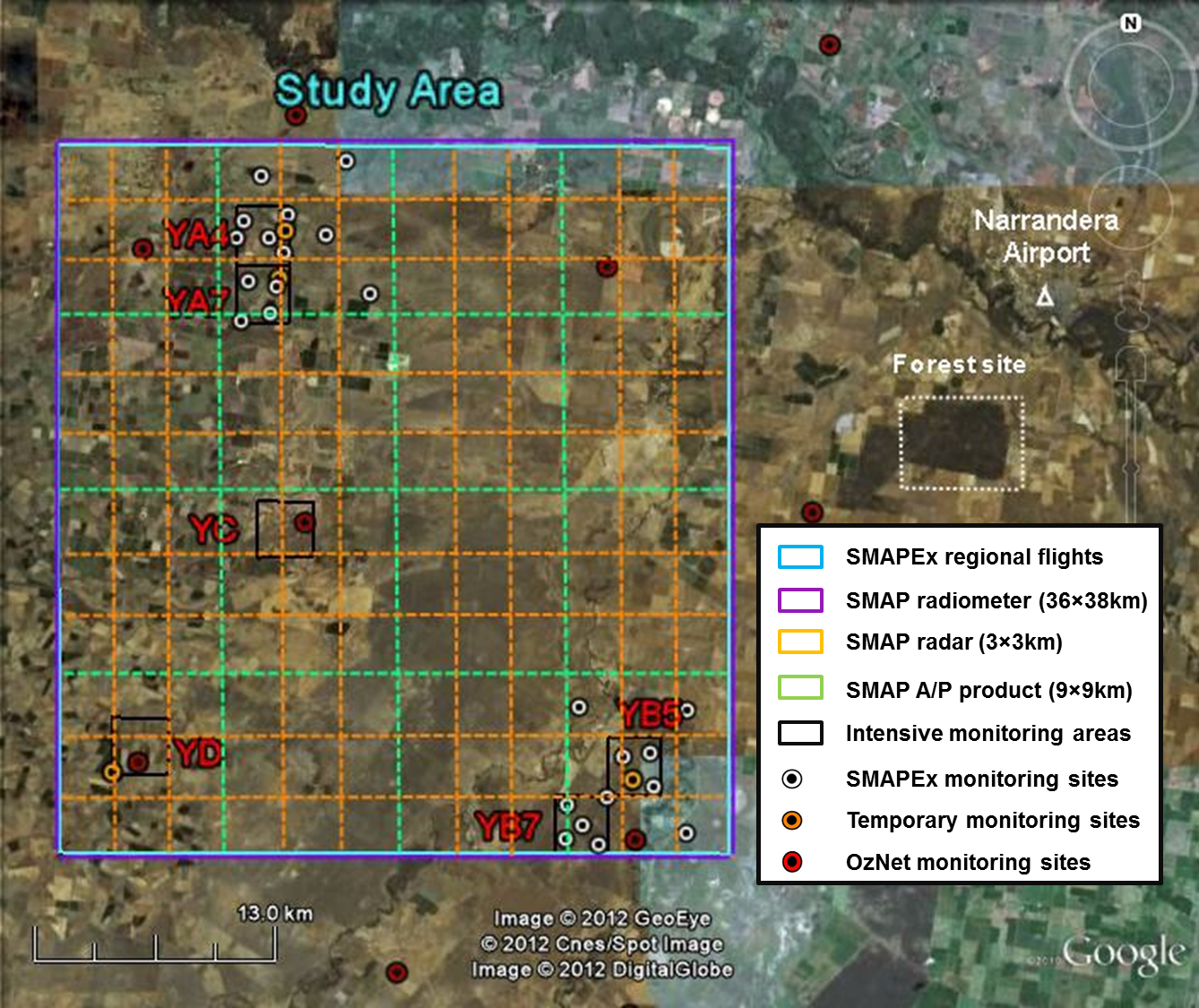
SMAPEx has utilized airborne radar and radiometer data to replicate the SMAP configuration in terms of frequency, viewing angle and resolution ratio. The main instruments flown are the Polarimetric L-band Multibeam Radiometer (PLMR) and the Polarimetric L-band Imaging Scatterometer (PLIS), with additional thermal infrared radiometer and multispectral sensors for monitoring of vegetation properties and surface temperature. SMAPEx has been undertaken in the "Yanco" study area, a semi-arid agricultural area in the Murrumbidgee catchment, south-eastern Australia. The main flights include coverage of a 36km x 38km area, equivalent to a SMAP radiometer pixel, with a 2-3 days "revisit" time to simulate SMAP observations both in spatial and temporal resolution. These airborne observations were undertaken at approximately 3000m (AGL) altitude to provide radiometer and radar data and derived soil moisture content at respectively 1km and 10-30m. Ancillary flights include lower altitude coverage of target areas and limited coverages to investigate radar specific issues.
Concurrently with each flight, supporting ground data on soil moisture, vegetation properties, soil temperature and surface roughness were collected at intensive monitoring sites. Moreover, the existing OzNet in situ soil moisture monitoring network was leveraged within the SMAPEx study area to support the unique products of SMAP. The SMAPEx network comprises 24 surface monitoring stations (0-5cm) and profile monitoring stations (0-90cm), distributed across an area equivalent to a SMAP radiometer pixel. Data for the SMAPEx and OzNet sites are available at the OzNet website.
Schedule of SMAPEx experiments
Experiment |
Date |
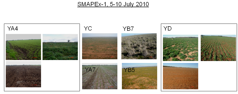
SMAPEx-1 |
5-10 July 2010 |
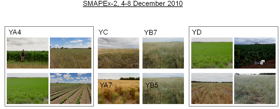
SMAPEx-2 |
4-8 December 2010 |
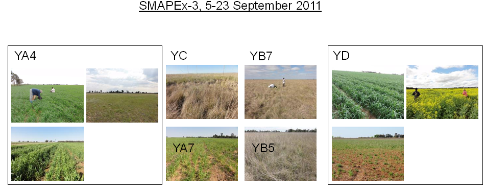
SMAPEx-3 |
5-23 September 2011 |
SMAPEx-4 |
1-22 May 2015 |
SMAPEx-5 |
7-27 September 2015 |
Images of the intensive sampling areas